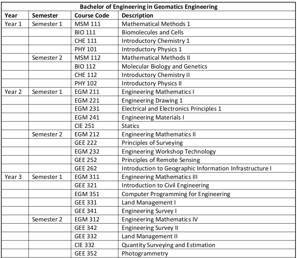
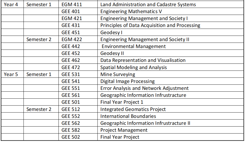
BACHELOR OF ENGINEERING IN GEOMATICS ENGINEERING

Introduction
Geomatics Engineering is the management of infrastructure through the collection, measuring, monitoring and archiving of geospatial data. It is a branch of engineering that involves survey of the entire or a part of the earth with various techniques (satellites positioning, satellite images processing, etc.) and the resulting spatial data is evaluated and expressed in maps and plans in the computer environment; It also deals with all kinds of position-dependent measurements, calculations, analysis and visualization studies.
Aims of the Programme
The aim of the program is to provide a comprehensive surveying education with an emphasis on both the theoretical and practical foundations. This is designed to encourage initiation on the part of the students and to prepare them for work in modern high-tech industries at the cutting-edge of technology. This training equips learners with the tools and imagination to address tomorrow’s problems. The course enables students to learn different aspects of geomatics and the advancement in different types of surveying. The course will expose students to the new frontiers of science like hydrographic surveying, Electronic distance measurement (EDM), Global Positioning System, Photogrammetry and Remote Sensing.
Objectives of the programme
At the end of the programme, graduates will be expected to:
Acquire knowledge to design and develop geospatial information about the land, infrastructure, natural resources, and the environment.
Learn how to operate systems for collecting, analyzing, and utilizing geospatial information about the land, infrastructure, natural resources, and the environment.
Demonstrate foundational knowledge of research principles and methods associated with Geomatics Engineering.
Integrate technical and cognitive skills in reviewing, analysing and synthesizing information to address specific themes in Surveying.
Demonstrate knowledge of physical principles underlying a variety of measurement techniques.
Further the knowledge of photogrammetry and cartography.
Demonstrated ability to conduct and interpret experiments using contemporary scientific instruments.
Get introduced to remote sensing technique
Communicate knowledge and ideas clearly and coherently by written and oral means.


